Some Loughs, Glens and Mountains of Donegal
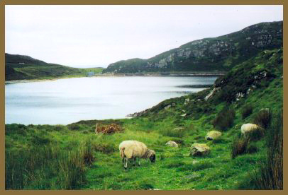
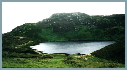
Lough Salt
Heading north from Kilmacrenan by the Creeslough Road, you turn into the first secondary road on your right. That road is quite narrow so keep a look out for areas on the side of the road that you may have to pull into (or reverse to). After four miles through grand mountain scenery and just before the summit the road takes a turn to the left, and suddenly the lake bursts into view.
What shocked the traveller's eye over 200 years ago is a positive delight to many who live in today's cluttered world, a place of singular tranquility and solitude, and there is a carpark from which you can enjoy the view from the comfort of your car. But to appreciate the place you must get out and walk. See there three Standing Stones near the next track after the carpark and notice how many patches of green cultivated land, like Meenlaragh, there are now among the mountains. Look out for wild thyme, hear the larks and you may see wheatears (small brown/grey birds from Africa with white rump and black tail) hopping cheerily from stone to stone. And, of course, there are the black faced sheep wandering everywhere. Go to the carpark at the north end of the lake for the panoramic view of the North Donegal coast.
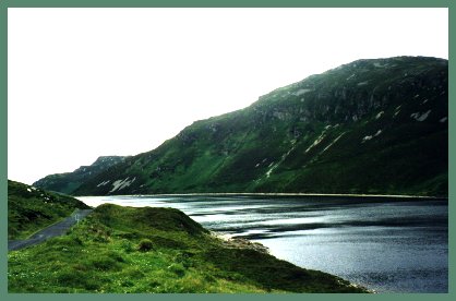
Lake Dunlewy
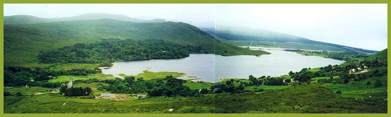
(This view shows Lake Dunlewy, with the Poisoned Glen to the left. The lower slopes of Mt Errigal are on the right)
The valley of Dunlewy has two lovely lakes and is overshadowed by Mt Errigal, the highest peak in County Donegal. On the shores of Lake Dunlewy is Ionad Cois Locha (the Lakeside Centre), which is housed in the reconstructed home of Manus Ferry, a famous Donegal weaver. There are audio-visual displays, a tea room, craft shop, and an outdoor area for children. You can also take a boat trip out onto the lake or go to the Teach Ceoil (music house) for some traditional music and dancing.
The Poisoned Glen
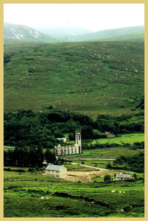
At the entrance to the Poisoned Glen stands the gaunt remains of the old parish church, built entirely of white marble quarried a few hundred yards away. For want of a congregation this church has been abandoned for a long time and in the graveyard adjacent there stands only one tombstone.
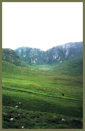
No road penetrates the mountain vastness of the Poisoned Glen, where three steep glens converge towards the awesome ice carved cliffs. A poisonous plant, or spurge, grows here - hence the name. The spurge has a milky but poisonous juice and its technical name is genus Euphorbia. The water is undrinkable, unless one wants to risk a stomach complaint, and there is no bird life, with the result that in July and August the insects amount to almost plague proportions; yet in the summer season this is one of the favorite places for the tourist. Another story how the Glen got it's name came from some French travellers who, having caught some fish there called it the Poison Glen.
|
(The Poisoned Glen and ice carved cliffs) |
(The old parish church at the mouth of the Glen) |
Mt Errigal
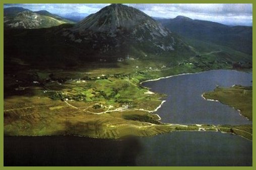
(View of Mt Errigal showing Lake Dunlewey - the Poisoned Glen is at the far right)
Errigal is the monarch of the Donegal Highlands and at 2,466 feet high, is the highest peak in the County. It is beautiful to behold, like a miniature Fujiyama, with its conical peak or white shingle stones, glistening in the sun. Many people climb Errigal in the summer - the climb is not too difficult and the ascent and descent can be completed in three hours. Access to the uppermost peak is via a narrow goat track where the ground falls away sharply on either side. If you have a poor head for heights be content with the lower ridge! I would have loved to climb Errigal, but with a toddler at my side, I'll have to wait until next time.