(Photograph by billpolley)
This is a compilation of records for Desertegney Parish which forms part of the Donegal Genealogy Resources Website
You may link to this page but not copy any of is content
If you have anything you'd like to add or would like to have yourself included in a Researchers section of these pages, then please Contact Me
Díseart Eignigh - Desertegny
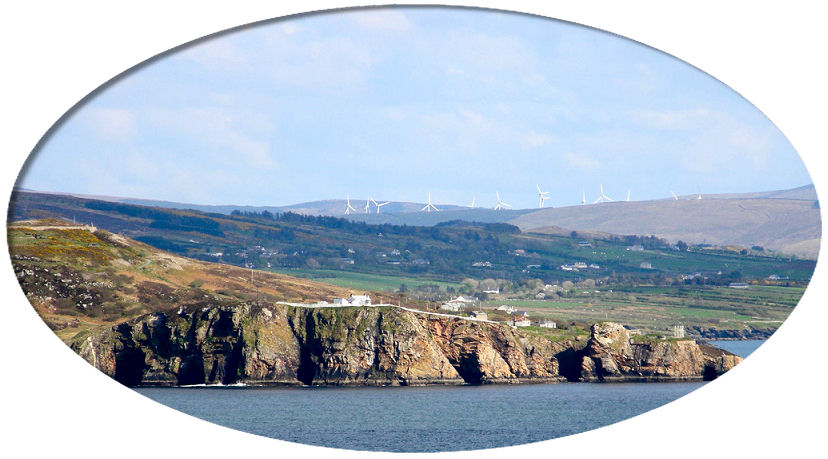
A parish in the barony of ENNISHOWEN, county of DONEGAL, and province of ULSTER, 13 miles (N. N. W.) from Londonderry; containing 1890 inhabitants. This parish is situated on the northern coast, amid the barren mountains of Ennishowen, and is bounded on the north by the Atlantic ocean, and on the west by Lough Swilly; it comprises, according to the Ordnance survey, 7577 statute acres, of which 5834 are applotted under the tithe act; the arable land includes 1794 acres; the remainder is mountain pasture. Some of the lower lands produce good crops of oats, flax, and potatoes; and wherever the mountains afford vegetation, they are depastured by numerous herds of small cattle and sheep. There are indications of copper and lead ore within the parish; and iron ore is abundant. The gentlemen's seats are Lensfort, the elegant residence of the Rev. W. Henry Hervey; and the glebe-house, of the Very Rev. Dean Blakeley. The living is a rectory, in the diocese of Derry, and in the patronage of the Marquess of Donegal : the tithes amount to £135; the glebe-house stands on a glebe of 166 acres, of which 88 are uncultivated. The church is a small neat edifice, with a square tower, situated close to the shore of Lough Swilly. In the R. C. divisions the parish forms part of the union or district of Upper and Lower Fahan and Desertegney; there is a small chapel, occupying the site of the old parish church. The parochial school, near the church, in which are about 30 boys and 15 girls, is a very neat edifice, erected in 1829 by the Rev. W. H. Hervey, and supported by him and a small donation from the rector. There are also two private schools, at Leaugin and Gortlick, in which are about 50 children; and a Sunday school. The gap of Ma-more is a remarkable natural curiosity on the confines of this parish, opening to the Atlantic ocean, and most extensive and magnificent views are obtained from the mountains near it. In the Erwys and other lofty mountains of this district, the eagles continue to build, and they prove very destructive to the young lambs on the mountains.
(Extract from A Topographical Dictionary Of Ireland by Samuel Lewis, 1837)
Last updated 10 Aug 2019
Births, Marriages and Deaths
- Births
- Marriages
- Deaths
Census
1740 Census
- 1841/51 Census
- Census Search Forms/Old Age Pension Applications
- 1901 Census
- 1911 Census
Churches
Families/People
Headstone Inscriptions
Land
- 1833 Tithe Applotment Book
- 1857 Griffith's Valuation
- Full Griffith's Valuation
Maps
- 1835 Ordnance Survey Maps
- Parish
- Parish Map & Data (Bob Hilchey)
Photographs
Researchers
Resources
- LDS Films
Townlands
Townland Area Ballyannan 1,306 Dunree An Dún Riabhach 212 Glebe 193 Gortleck 1,356 Gortyarrigan 632 Lederg 1,180 Liafin 489 Linsfort Lios Loinn 331 Meenalooban 130 Muineagh An Mhuineach 244 Sharagore 798 Tonduff 699
© 1998 Donegal Genealogy Resources


