This is a compilation of records for Killybegs Lower Parish, which forms part of the Donegal Genealogy Resources Website
You may link to this page but not copy any of is content
If you have anything you'd like to add or would like to have yourself included in a Researchers section of these pages, then please Contact Me
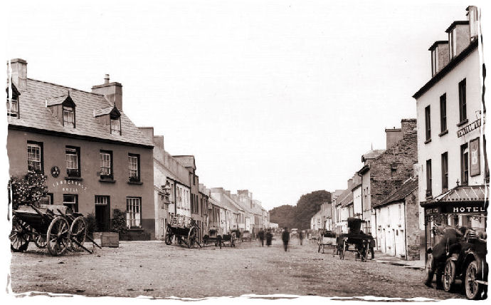
Na Cealla Beaga Íochtaracha - Killybegs Lower
The parish, from which a portion has been separated to form the district parish of Ardara, is for civil purposes distinguished into Upper and Lower Killybegs. It comprises, according to the Ordnance survey, 30,962 1/4 statute acres, of which 4304 1/4 are in that part of Lower Killybegs, which is in the barony of Boylagh; 1 l,074 1/4, including a detached portion, and 51 covered with water, are in the other part, in the barony of Bannagh; and 15,583 3/4, including 41 3/4 covered with water, are in Upper Killybegs, in the barony of Bannagh: 30,160 statute acres are applotted under the tithe act, of which about two-thirds are mountain and uncultivated land: agriculture is in a very unimproved state. The principal seats are Wood Hill, the residence of Major Nesbitt; and Fintra, of J. Hamilton, Esq. The living is a consolidated rectory and vicarage, in the diocese of Raphoe, and in the patronage of the Bishop; the tithes amount to £300. The church, a neat small edifice, was built on rising ground to the east of the town in 1829, at an expense of £1000. The glebe-house is of recent erection, and the glebe comprehends six townlands, comprising together 2000 Irish acres. In the R. C. divisions the parish is the head of a union or district, comprising also the parish of Killaghtee; the chapel here is a spacious and neat building, and there is also a chapel in Killaghtee. About 250 children are taught in two public schools, of which the parochial school is supported by an annual donation from Col. Robert-son's fund, and the other by -- Murray, Esq., of Broughton; there are also three private schools, in which are about 140 children, and a Sunday school. A small Franciscan friary was founded here by Mac Swiny Bannig, but there are no remains. Some ruins of the ancient castle of St. Catherine yet exist.
(Extract from A Topographical Dictionary Of Ireland by Samuel Lewis, 1837)
Last updated 10 Aug 2019
Births, Marriages and Deaths
- Births
- Marriages
- Deaths
Census
- 1841/51 Census
- 1901 Census
- 1901 Altnagapple
- 1901 Ardara Townland
- 1901 Ardara Town
- 1901 Ardlougher
- 1901 Ardvally
- 1901 Carrickatlieve Glebe
- 1901 Cashelodogherty
- 1901 Clonconwal (Glenconwal) updated
- 1901 Corraness Glebe
- 1901 Crocknagapple
- 1901 Cronkeeran
- 1901 Derries
- 1901 Doochill North
- 1901 Doochill South
- 1901 Drumbaran - nil return
- 1901 Drumnacross
- 1901 Garvegort Glebe
- 1901 Glenconwa (Clonconwal) updated
- 1901 Glengesh
- 1901 Gortnacart Glebe
- 1901 Kilrean Lower
- 1901 Kilrean Upper
- 1901 Lurganboy
- 1901 Meenachallow
- 1901 Meenawannia
- 1901 Meentinadea
- 1901 Mogumna
- 1901 Monargan Glebe
- 1901 Moy
- 1901 Mullanacloy
- 1901 Mullantiboyle
- 1901 Mulmosog
- 1901 Snugborough
- 1901 Stormhill
- 1901 Strawoaghter Glebe
- 1901 Tullyhonwar
- 1901 Woodhill
- Complete 1901 census online at NAI Census Website
- 1911 Census
Churches
- Church of Ireland
- Methodist Church
- Roman Catholic
Families
Headstone Inscriptions
- Holy Family, Ardara under construction
- Kilrean Graveyard
- St Conal’s, Kilclooney (1860) under construction
Land
- 1665 Hearth Money Roll
- 1796 Spinning Wheel Premium Entitlements List
- 1829-31 List of Persons who Applied to Register Freeholds
- 1829-31 Applications to Register Freeholds in the Barony of Boylagh
- 1834 Tithe Applotment Book
- 1857 Griffith's Valuation index
- 1857 Griffith's Valuation online
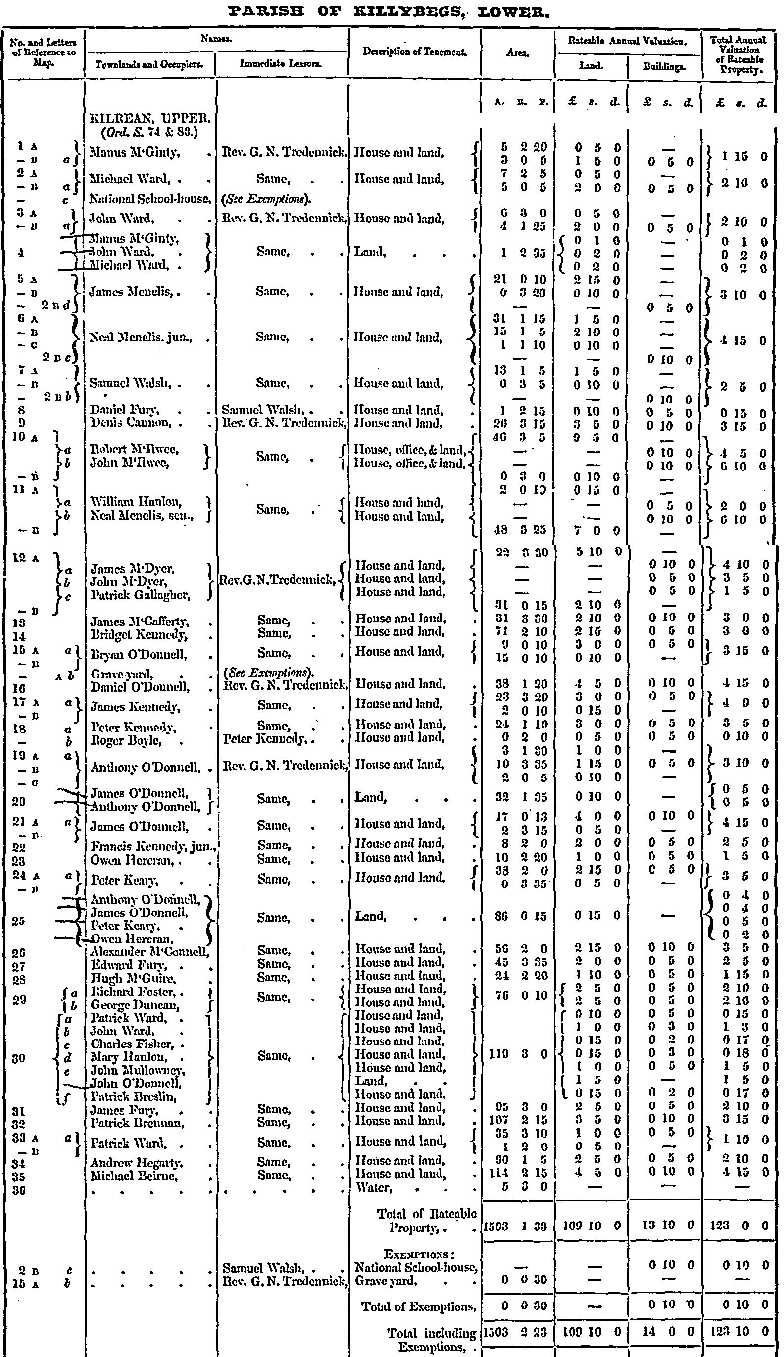
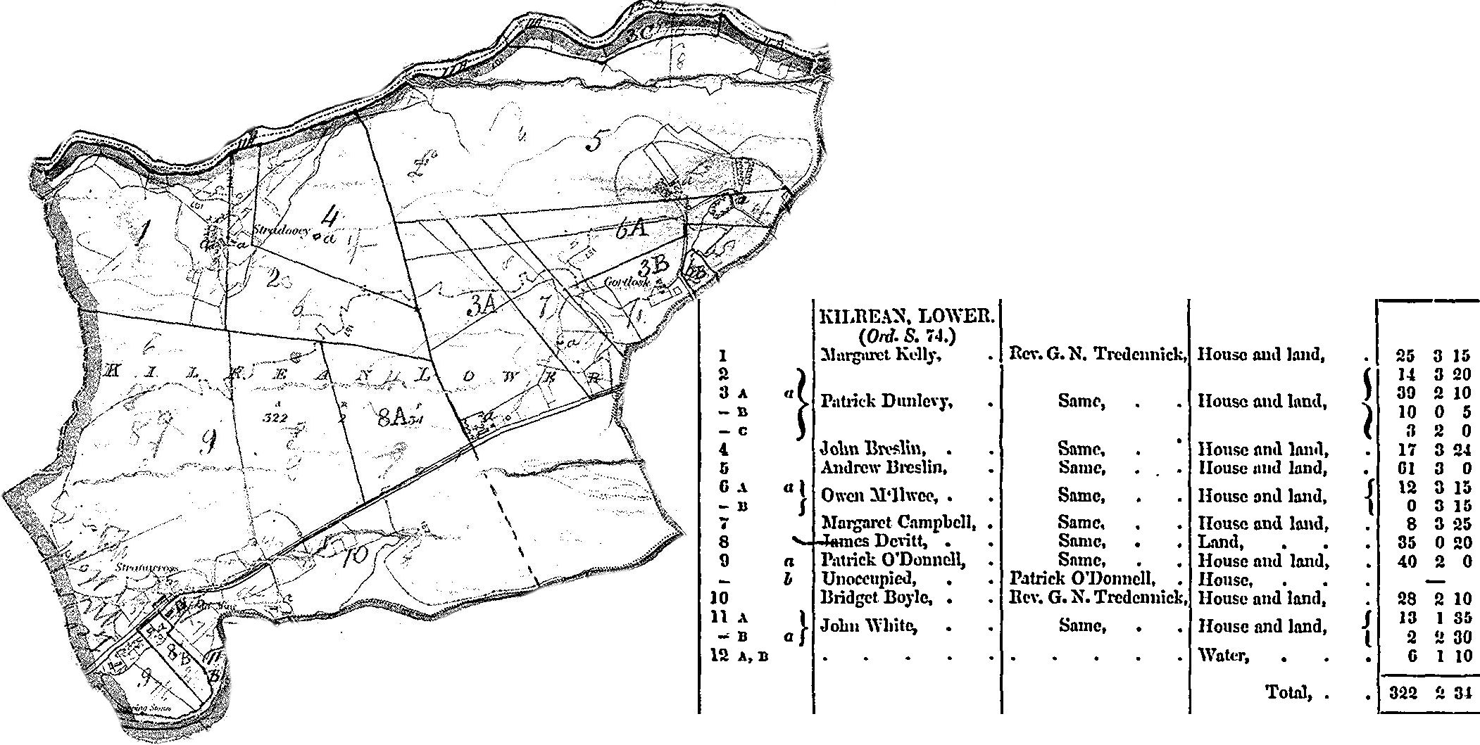
- 1857 Griffith's Valuation detailed
Who and what is there now? Select Donegal and enter townland name for current details

Links
Maps
- 1835 Ordnance Survey
Donegal Planning Map Search Zoom in for an aerial photo or detailed map of your favorite townland
- Parish
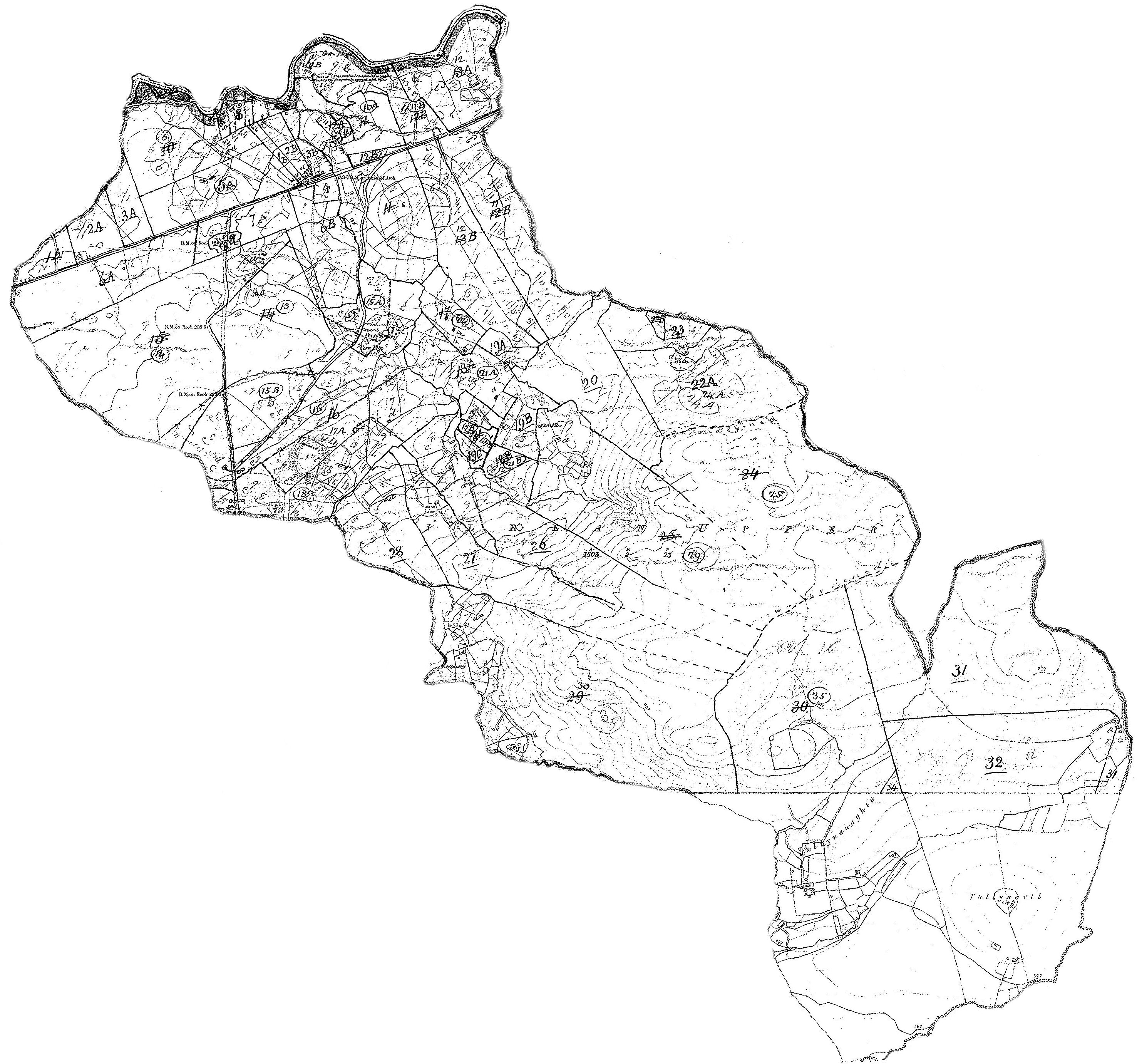
- Parish Map & Data (Bob Hilchey)
Media
- Ardara (YouTube video)
Registers
Researchers
- Diane - Bates from Ardara - Email
- George - Gallagher from Glengesh - Email
- Joe - Brogan from Ardara - Email
- John - Gildea from Ardara - Email
- Kathy - Campbell from Kilrean Lower - Email
- Lindel - Gallagher (O'Donnell) from Kilrean Lower - Email
- Mary - Boyle and Moloney from Ardara - Email
- Robert - Falls from Stormhill - Email
- Rose - Campbell from Gortlosk/Kilrean Lower - Email
- Shaun - Breslin from Kilrean Lower - Email
Resources
Townlands
Townland Area Altnagapple 454 Ardara 482 Ardara Town Ardlougher 184 Ardvally 160 Carrickatlieve Glebe 1,824 Cashelodogherty 106 Clonconwal 470 Corraness Glebe 383 Crocknagapple 818 Cronkeeran 320 Derries 398 Doochill North 448 Doochill South 152 Drumbaran 92 Drumnacross 318 Garvegort Glebe 411 Glencoe Snugborough Glenconwal Clonconwal Glengesh 1,626 Gortnacart Glebe 681 Kilrean Lower 322 Kilrean Upper 1,503 Lurganboy 71 Meenachallow 701 Meenakilwirra 442 Meenawannia 270 Meentanadea 217 Mogumna 201 Mogumna Mountain 108 Monargan Glebe 361 Moy 84 Mullanacloy 120 Mullantiboyle 98 Snugborough 406 Stormhill 100 Strawoaghter Glebe 720 Tullyhonwar 247 Woodhill 62
© 1998 Donegal Genealogy Resources