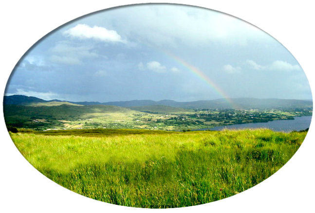

(Photograph by Louise Price)
The following project was started 8 Sep 2009 and forms part of the Donegal Genealogy Resources Website
You may link to this page but not copy it.
If you have anything you'd like to add or would like to have yourself included in a Researchers section of these pages, then please Contact Me
![]()
Cill Ó mBaird - Killymard
KILLYMARD, a parish, in the barony of BANNAGH, county of DONEGAL, and province of ULSTER, on the western side of the town of Donegal, from which it is separated by the river Esk; containing 4798 inhabitants. It comprises, according to the Ordnance survey (including a detached portion), 28,230 statute acres, of which 472 1/4 are in Lough Esk and 202 1/4 in smaller loughs: about 18,000 are barren mountain and waste land. The principal seats are Lough Esk, the residence of T. Brooke, Esq., and Rosselongan, of R. Steele, Esq. The living is a rectory and vicarage, in the diocese of Raphoe, forming the corps of the prebend of Killymard in the cathedral of Raphoe, and in the patronage of the Bishop: the tithes amount to £276. 18. 5 1/2. per ann. The late Board of First Fruits, in 1830, granted a loan of £800 for the erection of the church, and, in 1816, gave £200 and lent £600 for the erection of the glebe-house, which has a glebe of 643 statute acres, valued at £205 per annum. The R. C. parish is co-extensive with that of the Established Church, and has a small chapel. Here is also a place of worship for Presbyterians of the Seceding Synod, and one for Wesleyan Methodists. About 440 children are educated in six public schools, to one of which Mr. Murray, of Broughton, gives £5 annually; and 20 are educated in a private school. Here is a fine sulphureous spa of great efficacy in cutaneous diseases, over which Mr. Murray, its proprietor, has erected a pump-room, and hot, cold, and shower-baths.
(Extract from Lewis's Topographical Dictionary of Ireland, 1837)
![]()
Last Updated 10 Aug 2019
Births, Marriages and Deaths
-
Baptisms
-
Births
-
Marriages
-
Deaths
Books
Census
- 1821/1901
- Parish Census (Church of Ireland)
- 1841/51 Census
-
1901 Census
-
1901 Drumroosk East (uninhabited)
- 1911 Census
Churches
Families
Headstone Inscriptions
Land
- 1665 Hearth Money Roll
- 1796 Spinning Wheel Premium Entitlements List
- 1825 Tithe Applotment Book
- 1827-33 Civil Bill Ejectments
- 1829-31 List of Persons who Applied to Register Freeholds
- 1830 Householders (Edrim Glebe)
- 1857 Griffith's Valuation index
- 1857 Griffith's Valuation online
- 1857 Griffith's Valuation, Cancelled Valuation Books
- 1858 Housebooks (description & valuation)
- 1876 Landowners
Links
Maps
- Ordnance Survey 1835
- Parish
- Parish Map & Data (Bob Hilchey)
Registers
- School Registers
Researchers
Resources
- Resources held on Microfilm with the LDS
Townlands/Towns
| Townland | Area | |
| Abbernadoorny | 62 | |
| Altadoo | 487 | |
| Altilow | 1,092 | |
| Ballyboyle | 107 | |
| Ballyboyle Island | 30 | |
| Ballydevitt | 253 | |
| Ballydevitt Beg | 202 | |
| Beefpark | 53 | |
| Burns Mountain | 255 | |
| Clanboorhin | 254 | |
| Croaghanarget | 1,368 | |
| Croankeeran | 681 | |
| Donegal Town | ||
| Doocrow | 2,412 | |
| Doonan | 183 | |
| Drumark | 156 | |
| Drumcliff | 59 | |
| Drumgornan | 377 | |
| Drumgun | 83 | |
| Drumkeeghan | 334 | |
| Drummeenanagh | 265 | |
| Drumnacarry | 203 | |
| Drumroosk | 126 | |
| Drumroosk East | 103 | |
| Drumroosk Middle | 100 | |
| Drumroosk West | 100 | |
| Drumstevlin | 153 | |
| Eddrim Glebe | 641 | |
| Edergole | 4,370 | |
| Eglish | 2,554 | |
| Friary | 349 | |
| Glen | 68 | |
| Glencoagh | 115 | |
| Gortlosky | 88 | |
| Greenan | 1,477 | |
| Haugh | 202 | |
| Heneys | 334 | |
| Holmes | 51 | |
| Lackcrom | 828 | |
| Lougheask Demesne | 258 | |
| Meenacally | 175 | |
| Meenaguse More | 737 | |
| Meenataggart | 172 | |
| Meenawilderg | 159 | |
| Milltown | 46 | |
| Mullans | 134 | |
| Newtowndrumgornan | 339 | |
| Ogherbeg | 690 | |
| Owenboy | 288 | |
| Revlin | 100 | |
| Rossdoo Island | 2 | |
| Rossylongan | 154 | |
| Scrawhill | 61 | |
| Sruell | 2,772 | |
| Summerhill | 261 | |
| Tawnyvorgal | 135 | |
| Winterhill | 141 |
© 1998 Donegal Genealogy Resources
